German and Uzbek researchers collect land use data in Fergana Valley
Scientists from the University of Wuerzburg, SIC ICWC and ZEU had an expedition to Fergana Valley in June 2011. They collected reference data on agricultural fields needed for the evaluation of land use classifications derived from remote sensing data. Besides, measurements of the biophysical parameter Leaf Area Index (LAI) were carried out. The expedition was supported by the German fiat panis foundation.
Validation of high-resolution land use maps
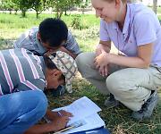
This field campaign is a follow up of the first campaign of CAWa work package 5 to Fergana Valley in June 2010. Scope of the work was the collection of field samples which are then used for the calibration and validation of land use maps derived from remote sensing data.
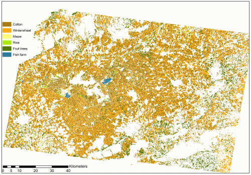
In 2011 about 1,600 land use samples were collected evenly distributed within Fergana valley. The main crops are cotton, winter wheat, rice, maize and fruit trees. The field data is used for an enhancement of the high-resolution land use classification for 2010 and for an update of the map for 2011. The high-resolution land use maps may be used in water management, e.g. to calculate the water demand for the whole Fergana valley or selected water user associations.

Additionally, the Leaf area index LAI was measured on wheat and cotton fields in the Water User Associations Azizbek and Akbarabad. Both, LAI and land use are important variables for the calculation of water demand. Therefore, they are also important data sets for CAWa work package 3. The selection of fields and the realization of the sampling was jointly conducted by the project partners of University of Wuezburg, ZEU and SIC ICWC.
Contact
University of Wuerzburg
Remote Sensing Department
Phone: +49 (0) 931-31-81876
Submitted by Katy Unger-Shayesteh on