CAWa experts support transboundary river basin authorities
Between October 2012 and March 2013, CAWa experts from the University of Wuerzburg supported initial steps towards the establishment of transboundary river basin authorities envisaged in the Isfara river basin, shared by Tajikistan and Kyrgyzstan, and the Murghab-Tedjen river basin, shared by Turkmenistan and Afghanistan. In the frame of the Transboundary Water Management in Central Asia Programme (TWMCA) implemented by the “Gesellschaft fuer Internationale Zusammenarbeit” (GIZ) as part of the “Berlin Process”, the researchers assisted in the generation of detailed land use maps, as well as the assessment of climate change impact and natural hazards.
Establishment of river basin authorities in small transboundary rivers
This challenging task is a major objective of the Transboundary Water Management in Central Asia Programme (TWMCA) implemented by the “Gesellschaft fuer Internationale Zusammenarbeit” (GIZ) and funded by the German Federal Foreign Office as part of the “Berlin Process” and the EU-Project “Supporting water management and strengthening transboundary river basin administrations in Central Asia” (WMBOCA). Within these programmes, river basin authorities are being set up for the Isfara river basin in the southern part of the Ferghana valley, shared by Tajikistan and Kyrgyzstan, and in the Murghab-Tedzhen river basin, shared by Turkmenistan and Afghanistan.
Researchers from the University of Wuerzburg aimed at strengthening the local capacities in river basin analysis and planning within three working packages: (1) data integration and generation of land use maps, (2) climate change and water availability scenarios, (3) evaluation of hazards associated with mudflows and floods.
Generation of a transboundary Land Use Map for the Isfara river basin
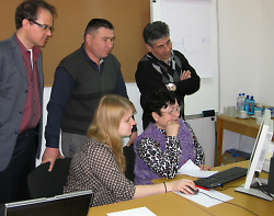
Two trainings were conducted in the district water management authorities of Batken (Kyrgyzstan) and Khujand (Tajikistan) in October 2012. They were designed to define the land-use classes to be considered in the map and to learn the technique of identifying and digitizing these classes in both, Google Earth and Landsat images.
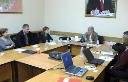
A final training with partners from both countries was given at the GIZ office in Khujand 4-7 March, 2013. One local expert, one representative of the Kyrgyz National Irrigation Research Institute in Bishkek and one representative of the Tajik Ministry for Amelioration and Water Resources in Dushanbe were invited for this common workshop. The results of the mapping campaigns on the national level were presented, discussed, and analyzed using a Geographical Information System (GIS).
In the end, a commonly agreed map on land cover and land use was compiled for the entire Isfara Basin from the bottom of the Fergana Valley up to the Alai Range. For this, of the researchers used mapping techniques, which were developed in work package 5 of the CAWa Project and are based on multi-temporal satellite data. The results were also used for the assessment of flood and mudflow risks.
Climate and water availability scenarios for 2050
Two workshops on the analysis of climatic indicators and the development of an algorithm for future water availability in smaller river catchments of Central Asia were hold in Ashgabad (Turkmenistan) and Khujand (Tajikistan) in January and February 2013. The work had a strong focus on the transboundary catchments of Murghab and Tedjen (shared by Afghanistan and Turkmenistan) and the South Fergana Valley including the Isfara Basin. Available knowledge and different types of data were collected and analyzed together with local experts of the Hydrometeorological Agency of Kyrgyzstan (Bishkek), the Hydrometeorological Survey of Khujand (Tajiksitan) and the Hydrometeorological Survey of Turkmenistan (Ashgabat).
Global (IPCC) and regional (CAWa-REMO) climate scenarios were utilized in combination with remotely sensed information on topography (SRTM) and precipitation (TRMM), as well as local meteorological measurements.
A comprehensive introduction into the use of climate models and the uncertainty of model outputs was given. By downscaling the modeling results to four local meteorological stations, temperature and precipitation scenarios until the year 2050 were developed. They indicate the spatial variability of change, which is likely to be expected.
A first simple algorithm to assess future water availability was developed. The results are planned to be validated against the more comprehensive studies carried out in work package 2 of the CAWa project.
Thus, the training provided useful tools for local experts to assess future water availability in small river basins of the Fergana Valley and similar catchments.
Natural risk assessment, focusing on floods and mudflows in the Isfara river basin
The focus of this work package was on the mapping of mudflows and floods and the assessment of the risk related to these extreme events in the Isfara catchment. Such water-related natural risks are of considerable relevance for the bi-lateral Isfara Basin Planning group. The initial working phases of this collaboration component were conducted with national experts of Tajikistan and Kyrgyzstan in Khujand/Isfara and Batken in 2012.
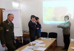
Annual lists of previous mudflow and flood events with significant damages were digitized using Google Earth and GIS-software and places at different risk levels were defined. During the final workshop in Khujand conducted at the GIZ office from 25 February – 1 March, 2013, basin-wide results were combined within a scientific analysis of hazards and risks. Data received from the land use mapping and the climate change groups which contributed the places at risk, a digital elevation model (SRTM), and remotely sensed precipitation information (TRMM) were included.
The maps were commonly compiled and discussed in the international working group consisting of representatives of the district water management authority of Batken (Oblvodchos) and the Committee for Emergency Situations (CES) of Khujand, the responsible national GIZ members in the TWMCA programme, and CAWa experts. Existing and planned protection measures were included in the maps with the intention to substantiate the discussion in the national and international working groups on the way to a transboundary river catchment authority between Kyrgyzstan and Tajikistan.
Опубликовано Katy Unger-Shayesteh в