First National WUEMoCA User Forum in Uzbekistan
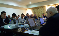
On 10 December 2015, the first National WUEMoCA (“Water Use Efficiency Monitor in Central Asia”) User Forum was held in Tashkent (Uzbekistan). The meeting gathered 20 representatives from the Basin Water Organisations Amudarya and Syrdarya, Basin Irrigation System Administrations, Irrigation System Administrations, and research institutions from all over Uzbekistan. Researchers and WUEMoCA developers from Wuerzburg University and SIC ICWC presented the preliminary version of the WUEMoCA web-tool, and discussed the specific requirements by users in irrigation management organisations.
The WUEMoCA Tool
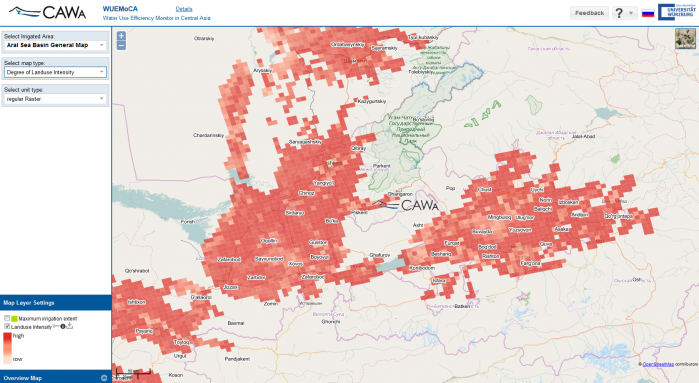
WUEMoCA is an online GIS-based tool for the regional monitoring of irrigated areas in Central Asia. The tool is being developed by Wuerzburg University in cooperation with SIC ICWC in the frame of CAWa phase III. It contains detailed annual maps of land use and crop yields based on openly accessible medium-resolution optical satellite data (MODIS, and for pilot regions Landsat) for the period after year 2000. In the mid-term, automated processing of newly incoming data will allow for the operational use of this tool in land and water management institutions across Central Asia. Potential future applications include assessments of marginal lands with low productivity, the intensity of land use, the early estimation of harvest shortfalls, and the assessment of water use efficiencies.
User perspective: Earth observation provides valuable information for water management
The participants of the User Forum agreed that modern Earth observation and information technologies have a high potential for improving water management in Central Asia as they provide a reliable data-basis, particularly in transboundary river basins. However, a main limitation to the usefulness of online tools in general is the still limited and difficult internet access in many places in Central Asia.
The participants concluded that the crop monitoring provided by WUEMoCA based on land use and yield maps is appropriate for decision making on regional and sub-regional levels. In particular, the information provided at different spatial aggregation levels (province, district, BISA, ISA, WUA, channel command area) is perceived as useful to identify areas with insufficient water supply.
The participants expressed their wish for an operational tool with near-real time data and analyses at monthly or even 10-day intervals. They developed the vision that, in the long-term, the information currently provided at scale of higher water management units should be available at the field level enabling consultation services and management support for individual farms.
WUEMoCA should become part of a larger data and model system, and could be coupled with existing water allocation models such as ASBmm (integrated model for assessment of Aral sea basin development scenarios). An important aspect of WUEMoCA would be the assessment of water use efficiency in irrigated agriculture. This requires the coupling of WUEMoCA with climate and water allocation data (on the ground) as well as water balance models. The users underlined that water use efficiency assessments should be differentiated according to water sources, i.e. river water, channel water, groundwater, and transboundary vs. inland waters.
Roadmap for further development of WUEMoCA
During the test phase in 2016, the focus will be on the early estimation of the expected yield for the current year and the experimental study of pilot areas. This includes a more detailed calibration and validation of the remotely sensed land use classification and the estimated yields for the main crops (cotton, wheat, rice, orchards, maize) in the Fergana valley and the Dargom canal area. This involves a number of field campaigns carried out by the partners SIC ICWC, and other research institutions in Uzbekistan. Specialists at SIC ICWC will take over the development of the water use efficiency module.
For 2017, the CAWa project will provide intensive training of potential users of the WUEMoCA tool. A cooperation with universities and research institutions across Central Asia is envisaged.
Workshop materials
Agenda WUEMoCA User Forum Tashkent (eng)
K. Unger-Shayesteh (GFZ): Introduction to the Regional Research Network “Water in Central Asia” (CAWa) (rus)
V. Dukhovny (SIC ICWC): Potentials for Utilizing Satellite Images for Land and Water Management in irrigated agriculture
C. Conrad (Wuerzburg University): The online tool WUEMoCA: A practical satellite-based water and land use management application
A. Sorokin (SIC ICWC): The demands by the potential users of WUEMoCA (rus)
L. Morper-Busch (Wuerzburg University): WUEMoCA live demonstration – Basic Functionalities
A. Sorokin (SIC ICWC): How can WUEMoCA support water management in Uzbekistan? (rus)
Submitted by Katy Unger-Shayesteh on